Mount Hermon Event
Mount Hermon Event
(((The United Nations (UN) has a military base on top of Mount Hermon (UNDOF). Officially to observe and guard over the Syrian, Libanon and Israeli border on basis of the historical wars and conflicts in the region. But this is also allegedly the place were, in ancient times, 200 Angels (The Watchers) descended to earth on a mission to observe and watch over GOD´s creation, mankind. They had strict rules of non-interventions to follow but somehow this went sideways resulting in major transgressions intermingling with mankind and leading them astray. The Watchers saw the human women as beautiful and decided to take wifes and make offspring with them (Nephilims). They took an oath together on this matter in direct confrontation and rebellion against GODS directioins.)))
.....
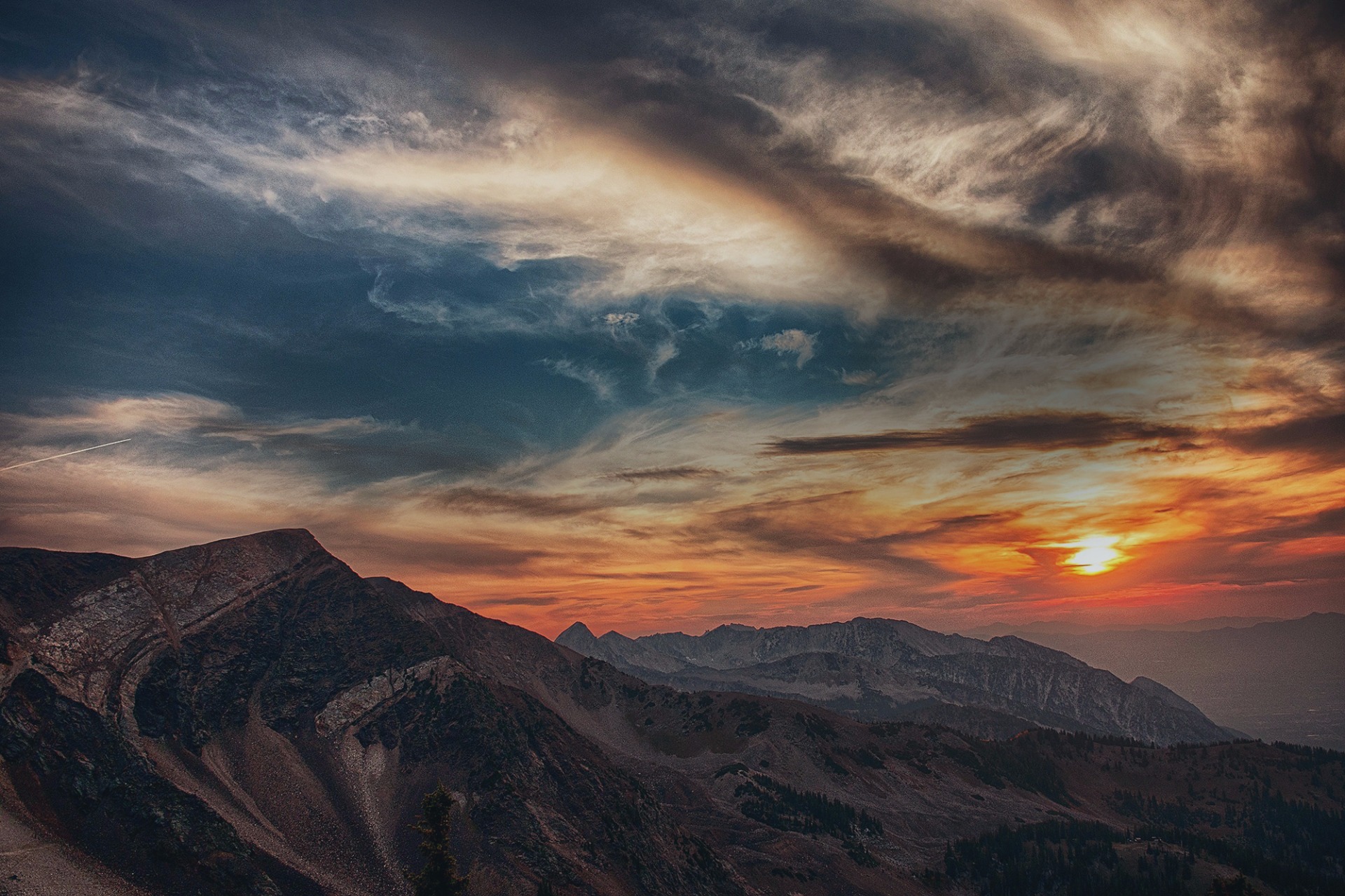
Mount Hermon (/ˈhɜːrmən/)[a] is a mountain cluster constituting the southern end of the Anti-Lebanon mountain range. Its summit straddles the border between Syria and Lebanon[2] and, at 2,814 m (9,232 ft) above sea level, is the highest point in Syria[3] and the Israeli-occupied Golan Heights.
On the top, in the United Nations buffer zone between Syrian and Israeli-occupied territories, is the highest permanently manned UN position in the world, known as "Hermon Hotel",[4] located at 2,814 metres (9,232 ft).[5] The southern slopes of Mount Hermon extend to the Israeli-occupied portion of the Golan Heights, where the Mount Hermon ski resort is located[6] with a top elevation of 2,040 metres (6,690 ft).[7]
Geography
Wider mountain range
The Anti-Lebanon range, of which the Hermon range constitutes the southernmost part, extends for approximately 150 km (93 mi) in a northeast–southwest direction, running parallel to the Lebanon range on the west.[8]
Hermon range
The relatively narrow Hermon range, with the Lebanon-Syria boundary along its spine, extends for 70 km (43 mi), from 25 km (16 mi) northeast of Mt. Hermon to 45 km (28 mi) southwest of it.[8] The Hermon range covers an area of about 700 km2 (270 mi2) of which about 70 km2 (27 sq mi) are under Israeli control.[8] Mount Hermon is a cluster of mountains with three distinct summits, each about the same height.[8] Most of the portion of Mount Hermon within the Israeli-controlled area constitutes the Hermon nature reserve.[8][9]
Water and flora
The mountain forms one of the greatest geographic resources of the area. Because of its height it captures a great deal of precipitation in a very dry area of the world. The Jurassic limestone is broken by faults and solution channels to form a karst topography. Mount Hermon has seasonal winter and spring snow falls, which cover all three of its peaks for most of the year. Melt water from the snow-covered mountain's western and southern bases seeps into the rock channels and pores, feeding springs at the base of the mountain, which form streams and rivers. These merge to become the Jordan River.[10]
The runoff facilitates fertile plant life below the snow line, where vineyards and pine, oak, and poplar trees are abundant.[10] Two Jewish liturgical poems from the 8th and 10th centuries indicate that vineyards were cultivated in the Hermon area during the early medieval period.[11]
Strategic importance
The springs, and the mountain itself, are much contested by the nations of the area for the use of the water. Mount Hermon is also called the "snowy mountain", the "gray-haired mountain", and the "mountain of snow". It is also called "the eyes of the nation" in Israel because its elevation makes it Israel's primary strategic early warning system.[12][13]
Religious significance
See also: Temples of Mount HermonRoman temple of Qasr el Banat, Lebanon
Various temples can be found in villages on the slopes of Mount Hermon.
Mount Hermon's name has been related to the Semitic root ḥrm, which means "taboo" or "consecrated", as in Hebrew ḥerem (in several contexts: property, priestly gift and censure), and in the Arabic term al-ḥaram, which means "sacred enclosure".[14][15] The name Hermon does not appear in texts prior to the Bible, but other names of the mountain (Siryon and Senir), which are mentioned in the Bible, appear in Bronze- and Iron-Age texts.[16]
Execration texts
in the Egyptian execration texts from the 19th century BC, šrynw (Siryon) is mentioned.[17]
Epic of Gilgamesh
The Epic of Gilgamesh mentions that Mount Hermon[clarification needed] split after Gilgamesh killed Humbaba, the Guardian of the Cedar Forest. One translation of Tablet V states, "The ground split open with the heels of their feet, as they whirled around in circles Mt. Hermon and Lebanon split."[18]
One of the versions of the Epic of Gilgamesh mentions ša-ri-a ù la-ab-na-na – Siryon and Lebanon – as the place of Anunnaki. This indicates Amorite influence.[19]
Hittite contract
In the contract between Muršili II and Duppi-Teššup of Amurru, two of the mountains that appear among the gods that witness the alliance are Lebanon and Siryon (šá-ri-ya-nu).[20][17]
Ugaritic religion
In the Ugaritic Baal Cycle, tablet KTU 1.4 IV, Baal goes "to Lebanon and his trees, Siryon – his desired cedars" for construction materials.[21]
The mountain or summit is referred to as Saphon in Ugaritic texts where the palace of Ba'al is located in a myth about Attar.[22][23][clarification needed]
Assyrian royal inscriptions
In the royal inscriptions of Shalmaneser III, Shalmaneser wrote that Hazael fortified the peak of mount sa-ni-ru (Senir[17]) "which is before mount Lebanon", and that after the defeat of Hazael, Shalmaneser marched to the Hauran.[24] In another part, Shalmaneser wrote that in his way from mount Lebanon to the cities of Hazael, he passed mount Saniru.[25]
The inscriptions of Esarhaddon mention several times cedars and cypresses from the mountains Lebanon and Sirara as construction materials;[26] Sirara may be a version of Siryon.[27]
Hebrew Bible and apocrypha
Hermon in the spring, viewed from the Golan heights
In Deuteronomy 3:8–9 and Joshua 12:1 and 13:11, Mount Hermon is depicted as the northern boundary of the Amorite kingdom, which following the conquest by Joshua was awarded to the half-tribe of Manasseh east of the Jordan River.[28]
The Hebrew Bible uses three names for Mount Hermon, stating in Deut 3:9 that "the Sidonians call Hermon Siryon, while the Amorites call it Senir", but elsewhere (1Chr 5:23) seems to distinguish between Senir and Hermon, probably using the names for two of the three peaks of the Hermon range, while in Psalm 42:6 the Hebrew text uses the plural form, Hermonim, possibly also a reference to the three peaks.[29][30]
The pair Siryon and Lebanon appears in Psalm 29, which is considered by Scholars to have Canaanite origin or roots.[31]
The Book of Chronicles mentions Mount Hermon as a place where Epher, Ishi, Eliel, Azriel, Jeremiah, Hodaviah, and Jahdiel were the heads of their families (1 Chronicles 5:23-24).
In Psalm 42, which leads the Psalms of the northern kingdom, the Psalmist remembers God from the land of Jordan and the Hermonites. In Song of Songs 4:8, Hermon is an instance of an exotic locale, and Psalm 133, one of the Songs of Ascents, makes specific reference to the abundant dew formation upon Mount Hermon.[32] The Book of Ezekiel (27:5), meanwhile, praises its cypresses (referring to it by its alternate name, Senir (cf. Deut. 3:9)).
In the apocryphal Book of Enoch, Mount Hermon is the place where the Watcher class of fallen angels descended to Earth. They swear upon the mountain that they would take wives among the daughters of men and take mutual imprecation for their sin (Enoch 6).
According to the controversial research by Professor Israel Knohl of the Hebrew University, in his book Hashem, Mount Hermon is actually the Mount Sinai mentioned in the Hebrew Bible, with the biblical story reminiscent of an ancient battle of the northern tribes with the Egyptians somewhere in the Jordan Valley or Golan Heights.[33]
New Testament
R.T. France, in his book on the Gospel of Matthew, noted that Mount Hermon was a possible location of the Transfiguration of Jesus,[34][35] just as it has elsewhere been described as the site accepted by most scholars.[36]
Qasr Antar inscription and Hermon as the "mountain of oath"
There is a sacred building made of hewn blocks of stone on the summit of Mount Hermon. Known as Qasr Antar, it is the highest temple of the ancient world and was documented by Sir Charles Warren in 1869. An inscription on a limestone stele recovered by Warren from Qasr Antar was translated by George Nickelsburg to read "According to the command of the greatest a(nd) Holy God, those who take an oath (proceed) from here." Nickelsburg connected the inscription with the oath taken by the angels under Semjaza who took an oath together, bound by a curse, in order to take human wives in the Book of Enoch (1 Enoch 6:6). Hermon was said to have become known as "the mountain of oath" by Charles Simon Clermont-Ganneau. The name of God was supposed to be a Hellenized version of Baʿal or Hadad and Nickelsburg connected it with the place name of Baal-Hermon (Lord of Hermon) and the deity given by Enoch as "The Great Holy One".[37]
(((The fallen ones created a city, Baal, at the the valley foot of Mount Hermon and it became a city of worship to Baal wich included child sacrifice))).
Deir El Aachayer Roman temple
Another Greek inscription found in a large temple at Deir El Aachayer on the northern slopes notes the year that a bench was installed "in the year 242, under Beeliabos, also called Diototos, son of Abedanos, high priest of the gods of Kiboreia". The era of the gods of Kiboreia is not certain, nor is their location, which is not conclusively to be identified with Deir al-Achayer, but was possibly the Roman sanctuary or the name of a settlement in the area.[38]
Religious importance in the Late Roman period
Eusebius recognized the religious importance of Hermon in his work Onomasticon (probably written in the first quarter of the 4th century), saying "Until today, the mount in front of Banias and Lebanon is known as Hermon and it is respected by nations as a sanctuary."[14]
References
- "Topographic map of Mount Hermon". opentopomap.org. Retrieved 2023-04-03.
- "ACME Mapper terrain display". mapper.acme.com. Archived from the original on 6 October 2014. Retrieved 28 March 2016.
- "CIA World Fact Book: Syria". 14 November 2011. Archived from the original on January 9, 2021. Retrieved 27 November 2011. highest point: Mount Hermon 2,814 m
- Gröppel, Ekkehard (April–June 2013). "It is time to say Goodbye!" (PDF). Golan: The UNDOF Journal (135). United Nations Disengagement Observer Force: 10–15. Retrieved 15 July 2015.
- "Mt Hermon – UNDOF's Vital Ground" (PDF). Golan: The UNDOF Journal (144). United Nations Disengagement Observer Force. July–September 2015. Retrieved 18 April 2019.
- The World's 18 Strangest Ski Resorts: The Mount Hermon Ski Resort Archived 2014-10-06 at the Wayback Machine, Shannon Hassett, Popular Mechanics
- The Hermon Ski Resort: About, homepage of the resort, accessed 9 August 2019
- The Hermon entry area Israeli Liberary of Technology for Education (in Hebrew)
- The Hermon Shoulder Israeli Ministry of Environment website (in Hebrew)
- The vegetation of Mount Hermon Mike Livneh (In Hebrew, Israel Mofet Unit of Research and Development, Dept. Of Education)
- Amar, Zohar. Agricultural Produce in the Land of Israel in the Middle Ages (in Hebrew). Jerusalem: Yad Izhak Ben Zvi. p. 101.
- If UN positions on Syria border fall to radicals Israel will have to respond Yacov Lapin, January 13, 2016 (Jerusalem Post)
- The Eyes of the Country have Closed Death of the soldier who coined the term "The eyes of the country" for a battle on the Hermon Mountain (in Hebrew, Ynet, 30 November 2006)
- Myers, E.A. (11 February 2010). The Ituraeans and the Roman Near East: Reassessing the Sources. Cambridge University Press. pp. 65–. ISBN 978-0-521-51887-1. Retrieved 18 September 2012.
-Wiki-
.....
UNDOF - United Nations Military Base.
In order to carry out its mandate, UNDOF maintains an area of separation, which is over 75 kilometres (46.6 miles) long and varies in width between approximately 10 kilometres (6.21 miles) in the centre to 200 meters (0.12 miles) in the extreme south. The terrain is hilly and is dominated in the north by Mount Hermon, which is the location of the globe's highest permanently manned United Nations position at an altitude of 2,814 meters (1,75 miles).
On each side of the Area of Separation (AOS) there is an Area of Limitation (AOL) with three zones; a zone of 0 to 10 kilometres (6.21 miles) from the area of separation, a zone of 10 (6.21 miles) to 20 kilometres (12.43 miles) from the area of separation, and a zone of 20 (12.43 miles) to 25 kilometres (15.53 miles) from the AOS. UNDOF with the support of UNTSO's Observer group Golan (OGG) continuously inspects and monitors these AOLs in order to ascertain that the agreed limitations in armaments and forces are being observed.
The responsibility for governance and policing in the area of separation remains with the Host Nation notwithstanding the presence of various armed groups within the area. In September 2014, due to the evolving Syrian conflict, UNDOF was required to reconfigure and consequently implement its mandate in a modified manner weighted on the A-Side. In 2016, UNDOF commenced a gradual re-establishment of its presence in Camp Faouar on the B-Side and in 2018, as the security situation improved, UNDOF commenced limited patrolling of the Area of Operations (AO) and has since continued to increase its operations.
-undof.unmissions.org-
.....